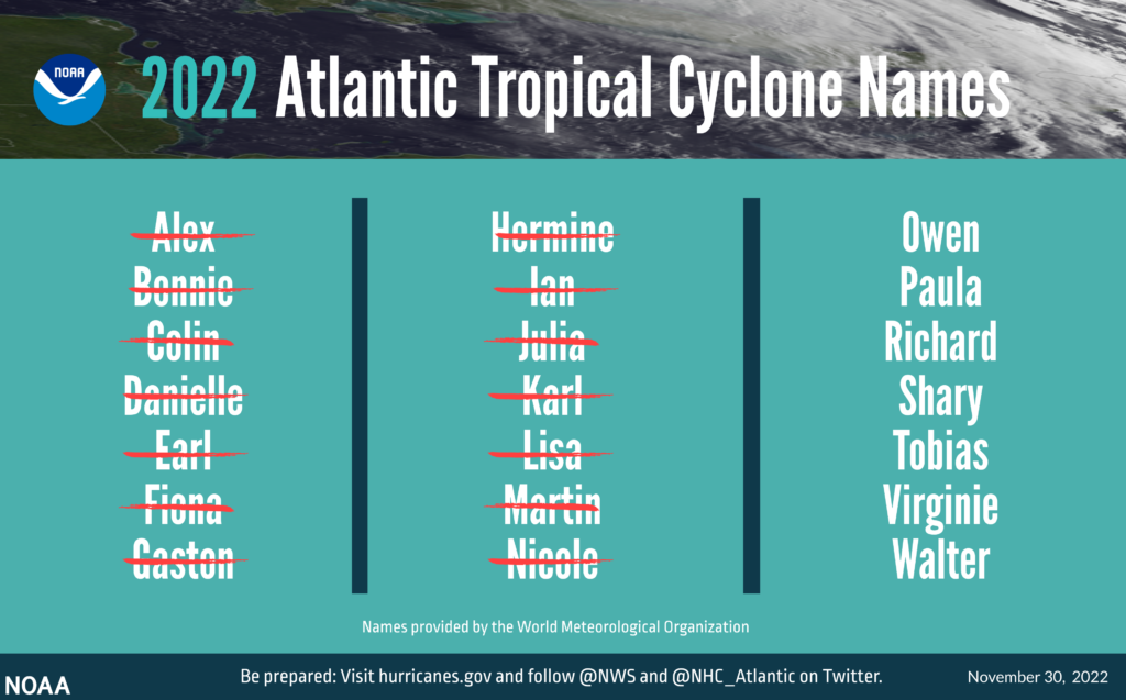
The 2022 Atlantic hurricane season officially ended on November 30, but the impact of Hurricanes Ian, Nicole and Fiona — which brought extensive damage to Florida’s coast and Puerto Rico, respectively — will continue to be felt long after the season is over.
In total, this hurricane season produced 14 named storms (winds of 39 mph or greater), of which eight became hurricanes (winds of 74 mph or greater) and two intensified to major hurricanes with winds reaching 111 mph or greater. An average hurricane season has 14 named storms, seven hurricanes and three major hurricanes.

The 2022 season saw three hurricane landfalls along the coast of the U.S. mainland. Hurricane Ian made landfall first as a Category 4 storm in Cayo Costa, Florida, and again as a Category 1 in Georgetown, South Carolina. As a Category 4 with 150 mph maximum sustained winds, Hurricane Ian tied for the fifth-strongest hurricane ever to make landfall in the U.S. Hurricane Nicole made landfall as a Category 1 in north Hutchinson Island, Florida.
Hurricane Fiona made landfall outside of the mainland U.S. as a Category 1 near Punta Tocon, Puerto Rico.
“I commend NOAA’s dedicated scientists, hurricane hunter pilots and forecasters who worked diligently to help American communities become hurricane resilient and Climate-Ready for the impacts of this hurricane season and the years to come,” said Secretary of Commerce Gina Raimondo.
This unique season was defined by a rare mid-season pause in storms that scientists preliminarily believe was caused by increased wind shear and suppressed atmospheric moisture high over the Atlantic Ocean. After a quiet period in August, activity ramped up in September with seven named storms, including the two major hurricanes — Fiona and Ian — seen this season. The season also included a rare late-season storm with Hurricane Nicole making landfall on November 10 along the east coast of Florida.
“Forecasters at NOAA’s National Weather Service and its National Hurricane Center issued earlier forecasts with increasing accuracy this season,” said NOAA Administrator Rick Spinrad, Ph.D. “These improved forecasts coupled with critical NOAA data and services undoubtedly led to the better protection of life and property.”
National Hurricane Center forecasts were aided by the experimental peak storm surge graphic, which allowed forecasters to more accurately communicate the severity of expected storm surge levels produced by landfalling storms, such as Hurricane Ian. Additionally, NOAA’s intensity forecasts showed Hurricane Ian as a major hurricane impacting the coast of Florida from the initial advisory on September 23 through landfall five days later. This advanced lead time gave those in threatened areas more time to prepare and respond.
“The 2022 seasonal activity fell within NOAA’s predicted ranges for named storms and hurricanes in both our pre-season outlook and updated outlook,” said Matthew Rosencrans, lead hurricane forecaster at NOAA’s Climate Prediction Center. “La Niña conditions remained robust throughout the season while the West African Monsoon was only slightly above normal, which both largely aligned with conditions anticipated by the team at NOAA.”
NOAA’s hurricane research and response
This season, NOAA Hurricane Hunter aircraft flew over 582 mission hours to collect atmospheric data that is critical to hurricane forecasting and research, passing through the eye of a hurricane 65 times and deploying over 1,700 scientific instruments. NOAA’s Gulfstream IV-SP also flew a research mission from Cabo Verde, Africa, in August. This historic mission was the furthest east NOAA’s Hurricane Hunter airplanes have flown to investigate a developing storm.
Another major first included the successful launch of the Altius 600 small uncrewed aircraft system by scientists from NOAA’s Atlantic Oceanographic and Meteorological Lab. Scientists launched the instrument from NOAA’s P-3 Hurricane Hunter into the core of Hurricane Ian hours before landfall, transmitting back data of wind speeds as high as 216 mph at an altitude of 2,150 feet.
NOAA’s National Ocean Service captured thousands of aerial overflight images after Hurricane Ian. The images helped identify and record more than 6,200 potential pollution risks and assisted the U.S. Coast Guard in clearing pollution from the environment and facilitating marine debris cleanup efforts. A NOAA King Air and Twin Otter aircraft flew over 41 mission hours to support aerial imagery collection for emergency response after Hurricanes Ian and Nicole.
Forecasters and researchers relied on this invaluable data coupled with NOAA’s advanced geostationary and polar-orbiting weather satellites, NOAA’s weather buoys and other sources before, during and after storms throughout this destructive hurricane season.
While the 2022 season is drawing to a close, now is not the time to let your guard down. The 2023 hurricane season will officially begin on June 1. Take the time to ensure your family is Weather-Ready for the season ahead. NOAA’s Climate Prediction Center, a division of the National Weather Service, will issue its initial 2023 seasonal outlook in May.


