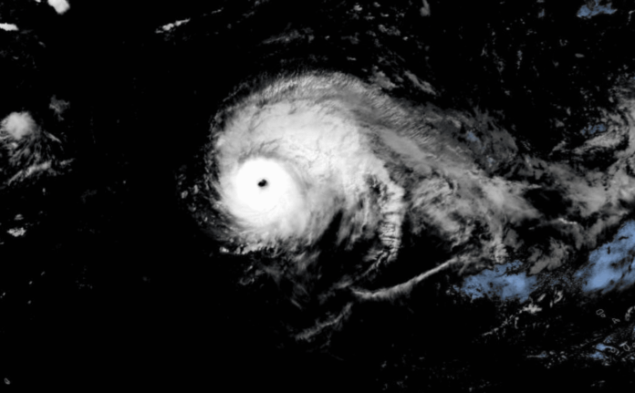
The 2020 Atlantic hurricane season starts June 1, and the U.S. Geological Survey is prepared to provide science that can help guide efforts to protect lives and property if a major storm makes landfall this season.
Already there have been two tropical storms before the official start of the 2020 Atlantic hurricane season, which goes from June 1 to Nov. 30. This year there is a 60% chance of an above average season and a 30% chance of a near-normal season according to the National Oceanic and Atmospheric Administration Climate Prediction Center’s 2020 hurricane season forecast. An average hurricane season produces 12 named storms with winds of 39 miles per hour or higher, and includes six hurricanes, three of which are major hurricanes with winds of 111 miles per hour or higher. This year the NOAA forecast calls for 13 to 19 named storms, of which six to 10 could become hurricanes with three to six of those being major hurricanes.
Tropical storms, hurricanes and other large coastal storms can impact seaside and inland communities and ecosystems with high winds, storm surge, erosion and flooding. These forces can destroy buildings, roads and bridges and reshape the nation’s coastline.
When a major storm threatens to make landfall in the United States or its territories, the USGS provides comprehensive scientific capabilities and information that decision makers, emergency responders and communities can use to help them prepare, cope with and recover from a storm. This includes the USGS’s ability to forecast coastal change; track storm surge, river and stream levels and flow; capture high-resolution ground elevation and topographic data; create detailed maps that can be used by disaster teams responding in the aftermath of storms; and measure coastal and inland flooding across entire regions.
Forecasting Coastal Change as a Hurricane Approaches
Before a storm’s expected landfall, USGS coastal change experts forecast how a storm may reshape the coastline using a sophisticated system they developed called the coastal change hazard forecast model.
The model provides detailed forecasts of a strong storm’s likely effects on sandy shorelines along the Atlantic and Gulf coasts. It predicts where protective sand dunes are likely to be eroded at their bases or overtopped by storm waves and where coastal areas behind the dunes could be inundated by seawater.
These forecasts can help emergency managers make critical decisions before a major storm strikes, including which areas to evacuate, which roads to use and where to position storm cleanup equipment. The forecasts typically begin 72 hours before a storm is expected to make landfall, are updated based on the latest forecasts from the National Hurricane Center and are available at the USGS Coastal Change Hazards Portal. The site has recently been updated with new coastal elevation data that reflect sandy shoreline changes brought by recent hurricanes and new scenarios of storm-induced erosion. This allows forecasts for the 2020 hurricane season to be based on the latest information available.
Working with the National Weather Service, the coastal hazards storm team also updates forecasts for some areas several times a day using real-time water levels from the weather service’s Nearshore Wave Prediction System. The team’s Total Water Level and Coastal Change Forecast Viewer displays results from a new model that currently covers about 1,865 miles of coastline in select areas from Florida through Maine. The model predicts the timing and height of water levels at the shoreline as well as potential impacts to coastal dunes. NOAA will use the predictions to help inform forecasters at the National Hurricane Center. As the program’s coverage area expands, the predictions will also be made available to National Weather Service forecasting offices and to the public.
“We are working to expand the Total Water Level Viewer to include the Gulf coasts of Texas, Alabama and the Florida panhandle, as well as additional areas along the Atlantic coast which will give us about 2,900 miles of total coastline coverage,” said oceanographer Kara Doran, USGS Coastal Change Hazards Storm Team leader. “We hope the new information will be publicly available sometime later this season.”


