


In August, the Science and Technology Directorate (S&T) and its National Urban Security Technology Laboratory (NUSTL) collaborated with a number of federal and industry partners on a series of air domain awareness technology demonstrations in Montana. This second round of demonstrations served as a follow-up to a previous round of tests that were held in North Dakota this past April. The purpose of both of these demonstrations and tests was to evaluate specialized air domain awareness technologies such as radar systems; electro-optical and infrared cameras; radio frequency detection systems; and acoustic devices to see how effectively each can monitor, safeguard, and secure the various terrains and airspace that surround the northern border between the U.S. and Canada.
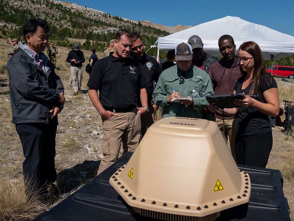
Our most recent round of technology demonstrations took place over three weeks at the Montana National Guard’s Limestone Hills Training Area in Townsend, Montana. The photos below offer a behind-the-scenes look at the tests, the technologies, and the terrain in this mountainous region of our northern border.

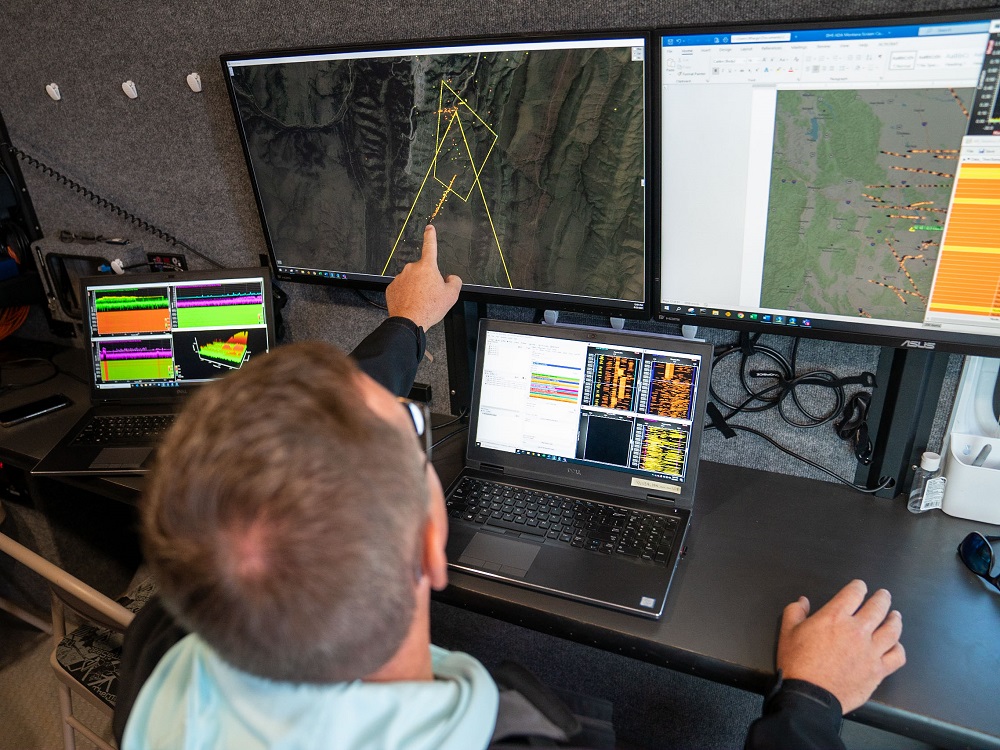
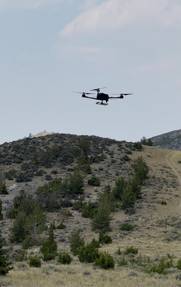
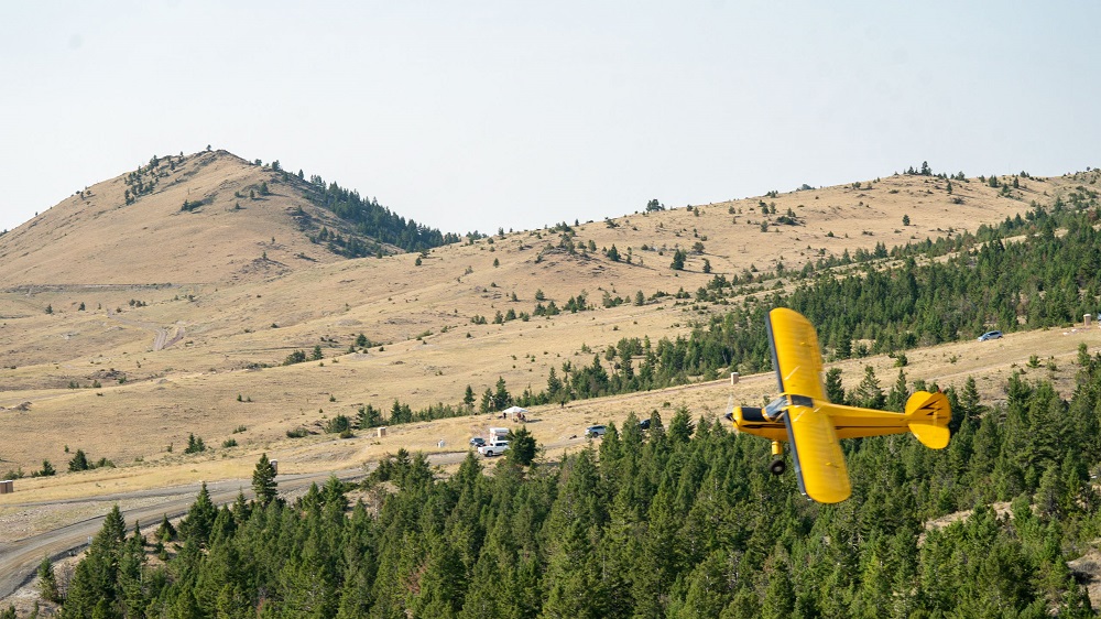
S&T and its partners spent long days conducting dozens of flights and technology assessments over the course of the testing. Held at random times of the day and in varying weather and environmental conditions, these assessments allowed us to evaluate whether the specialized systems had the capabilities required to quickly and accurately detect, track, identify, and respond to incursions from various types of low, slow-flying aircraft—both manned and unmanned.
“In order for these technology demonstrations to be effective, it’s vital that we evaluated these various technologies in different terrains,” said S&T technical lead Tim Bennett.
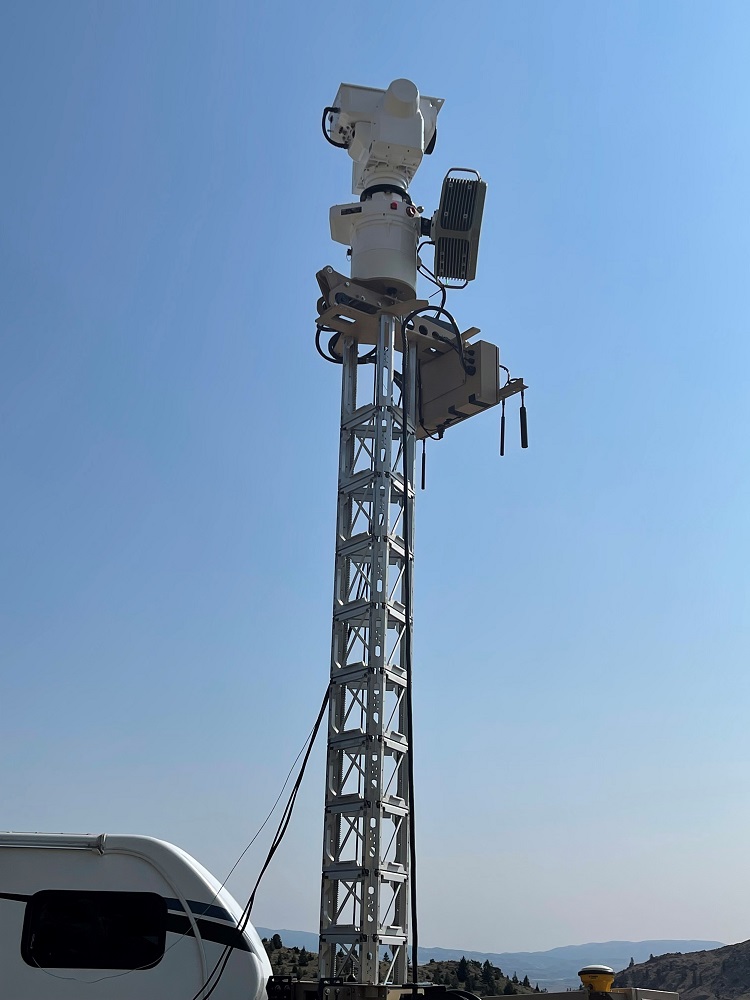
Montana’s mountainous landscapes make it susceptible to drug smuggling, human trafficking, and other illegal activities conducted via manned and unmanned aircraft. S&T tested various radars; electro-optical and infrared cameras; and acoustic systems to gauge how accurately they could detect and track these aircraft as they flew in the valleys and behind the mountains near the border.
The aerial surveillance technologies, sensors, and capabilities that DHS eventually implements at the northern border will need to be able to detect everything that travels through this airspace. The rigorous testing conducted at Limestone Hills (and in North Dakota earlier this year) will further help S&T to determine which of these tools will be ideal for preventing and responding to illegal activities at these crucial points-of-entry into the country.
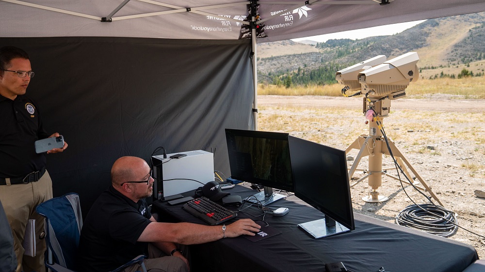
“One of the key metrics we’ll be looking at during our post-demonstration data analysis is ground truth information,” explained NUSTL engineer Blaise Linn. “In the context of air domain awareness, this is defined as the real-time location of an aircraft as its traveling. To measure ground truth information, we equipped all aircraft that were flown at Limestone Hills with GPS transmitters, then tracked them during test flights. As we analyze our findings from the demonstrations in Limestone Hills, we will be comparing our ground truth information with data obtained from our vendors and their technologies. This side-by-side comparison will help us to determine how well their systems were able to perform in a mountainous environment and how accurately they were able to detect our aircraft.”
While the Limestone Hills demonstrations are over, there is still much more work to do. The data collected and analyzed from these tests, along with the data from previous demonstrations in North Dakota, will provide valuable information about the selected tools and their capabilities and limitations when it comes to detecting aircrafts in the field. S&T is currently developing comprehensive reports detailing the technologies that were tested, their capabilities, and how they each performed in the field. These reports will then be shared with all federal agencies and organizations looking to procure and implement ADA technologies at the northern border and other key points of entry around the country.


